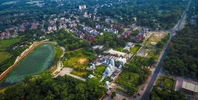
Kurnool is one of the major urban centres of Andhra Pradesh’s Rayalaseema region and the administrative headquarters of Kurnool district. The city has long functioned as a regional centre for government services, education, healthcare, trade and transport. Its location close to the Tungabhadra and Hundri river systems and on the Hyderabad-Bengaluru highway corridor gives it a strong connection with both Telangana and the southern districts of Andhra Pradesh.
The city is especially important for road travel because National Highway 44 passes through the Kurnool urban corridor, while National Highway 40 begins from the Kurnool side and runs toward Nandyal, Kadapa and Chittoor. Kurnool City railway station handles regular passenger traffic, and Uyyalawada Narasimha Reddy Airport at Orvakal provides regional air access. The main Kurnool postal code is 518001.

Quick About Kurnool City Andhra Pradesh
| Detail | Information |
| State | Andhra Pradesh |
| District | Kurnool |
| Region | Rayalaseema |
| Main PIN code | 518001 |
| Major highways | NH 44 and NH 40 |
| Railway station | Kurnool City Railway Station |
| Airport | Uyyalawada Narasimha Reddy Airport, Orvakal |
| Local transport | APSRTC buses, autos, cabs and private vehicles |
| City character | Administrative, commercial, educational and residential |
| Nearby areas | Kallur, Orvakal, Kodumur, Nandyal-side corridor, Adoni-side corridor |
Where is Kurnool City Located in Andhra Pradesh?
Kurnool is located in western Andhra Pradesh and serves as the headquarters of Kurnool district. The district administration notes the city’s historic role as the capital of Andhra State from 1953 to 1956, and it remains one of Rayalaseema’s main administrative centres.
The urban area sits close to the Tungabhadra River, with the Hundri River joining the Tungabhadra at Kurnool. Its position near the Telangana border and along the Hyderabad-Bengaluru transport corridor has made it an important stop for both interstate and regional movement.
The wider urban influence extends into Kallur and the roads toward Orvakal, Nandyal, Kodumur and Adoni. For daily travel, the exact side of Kurnool matters because highway access, railway access and congestion around the central market area can differ significantly.
Kurnool City Areas and Urban Layout
- Central Kurnool: The older commercial and civic core around markets, government offices and established neighbourhoods.
- Kallur side: A major residential and urban extension closely integrated with Kurnool’s built-up area.
- NH 44 corridor: Important for interstate movement, logistics, hotels and newer development on the highway side.
- Orvakal side: Useful for access toward Kurnool Airport, industrial development and eastern district roads.
The city combines a dense traditional centre with outward growth along its national highways and radial roads, so route choice often depends on which side of Kurnool a destination is located.
Kurnool City PIN Code
The main PIN code for Kurnool is 518001. India Post separately lists other Kurnool urban postal codes such as 518002, 518003, 518004 and additional codes for specific neighbourhoods and institutions.
This means 518001 should not automatically be used for every address within the wider Kurnool urban area. Large campuses, colonies and suburban pockets may be served by a different post office.
For property registration, bank documents, deliveries or school records, match the PIN with the exact locality and post office rather than relying only on the city name.
Road Connectivity
National Highway 44
NH 44 places Kurnool on the main Hyderabad-Bengaluru road axis. It is the city’s most important north-south highway and carries interstate buses, freight and private traffic.
National Highway 40
NH 40 connects from the Kurnool side toward Nandyal, Kadapa, Rayachoti, Chittoor and the Tamil Nadu side. It is a key Rayalaseema route for regional road journeys.
Adoni, Kodumur and District Roads
Regional roads link Kurnool with Kodumur, Yemmiganur, Adoni and numerous towns and villages in the western part of the district.
| Road/Route | Useful For |
| NH 44 | Hyderabad, Mahbubnagar side, Anantapur and Bengaluru |
| NH 40 | Nandyal, Kadapa and Chittoor corridor |
| Orvakal Road | Airport and Orvakal-side development |
| Kodumur Road | Kodumur and western district movement |
| City arterial roads | Bus stand, railway station, markets and residential areas |
Rail Connectivity
Kurnool City Railway Station is the principal station serving the city and provides rail links toward Hyderabad, Bengaluru and other destinations on the wider network. The station’s central role is particularly useful for travellers who prefer rail over long highway journeys.
Local access to the station is mainly by autos, city buses, cabs and private vehicles. During busy travel periods, road congestion around the central city can add time, so passengers should allow a buffer before departure.
Rail is also relevant for students, government employees and business travellers who make regular intercity trips from Kurnool rather than using private cars or buses.
Bus and Airport Access
APSRTC services connect Kurnool with Hyderabad, Bengaluru, Nandyal, Adoni, Kadapa and many district towns. Because Kurnool is on major national highways, intercity bus travel is one of the city’s strongest transport options.
Uyyalawada Narasimha Reddy Airport, also known as Kurnool Airport, is located near Orvakal. Andhra Pradesh Airports Development Corporation identifies it as an operationalized airport serving Kurnool. The airport is reached by road from the city.
For routes not covered by local flights, Hyderabad’s Rajiv Gandhi International Airport remains another option, although the road journey is considerably longer.
Nearby Areas Around Kurnool City Andhra Pradesh
- Kallur: A major adjoining urban area closely connected with Kurnool’s residential growth.
- Orvakal: Known for the airport, rock garden area and industrial development east of the city.
- Kodumur: A town southwest of Kurnool connected by regional road.
- Nandyal: A major city to the east, reached through the NH 40 corridor.
- Adoni: An important western district city connected through regional roads and rail routes.
- Alampur side: The Telangana-side corridor north of Kurnool, useful for travel toward Hyderabad.
FAQs
Q. Is Kurnool a useful base for regular Hyderabad travel?
Yes. NH 44 provides a direct road corridor toward Hyderabad, and rail and bus services give alternatives to driving.
Q. Which highway is more important for travel toward Nandyal and Kadapa?
NH 40 is the main corridor from the Kurnool side toward Nandyal and continues farther through the Rayalaseema region.
Q. Does all of Kurnool use PIN code 518001?
No. 518001 is the main Kurnool code, but the city has several additional postal codes for different neighbourhoods and institutions.
Q. Is Kurnool Airport inside the main city?
No. The airport is at Orvakal outside the central urban area, so travellers need to plan a road transfer.
Q. What should a family check before renting near the highway?
Check service-road access, noise, safe pedestrian movement, school routes and whether daily errands require crossing major highway junctions.
Q. Is the railway station or bus network better for regional travel?
Both are useful. Buses provide flexible connections to many nearby towns, while trains can be more convenient for selected longer routes and scheduled intercity journeys.