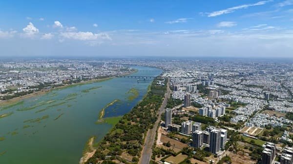
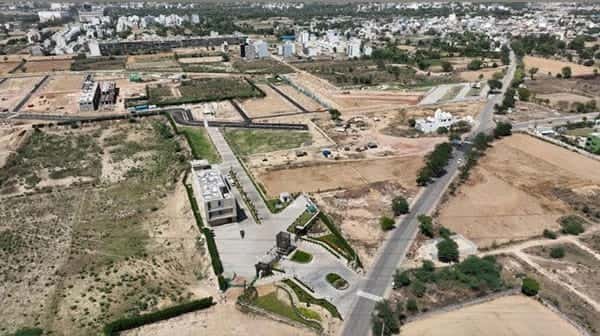
Ambala City is one of the principal urban centres of north-eastern Haryana and forms the civilian, commercial and administrative half of Ambala’s well-known twin-city structure with neighbouring Ambala Cantonment. Its identity is shaped as much by trade as by geography. Haryana Tourism describes Ambala City’s cloth market as a major regional draw with roughly 900-1,000 wholesale shops, while the wider Ambala economy is also associated with scientific instruments, light engineering, agriculture and services. The city’s older bazaars, grain and textile trading streets, government institutions and residential colonies give it a markedly different character from the military and railway-dominated cantonment nearby.
Ambala’s importance is amplified by its position at a strategic crossroads between Haryana, Punjab, Chandigarh and the Himalayan gateway routes. Delhi-bound traffic from Chandigarh and Punjab converges here, while roads branch toward Kaithal, Yamunanagar, Patiala and the Shivalik foothills. This has made Ambala City a natural distribution, education, healthcare and service centre for a much wider region. The City and Cantt sides are closely connected in daily life, but they remain distinct urban references with different postal zones, railway stations and local commercial centres, so understanding that split is essential for accurate travel and address planning.
Quick About Ambala City Haryana
| Detail | Information |
| State | Haryana |
| District | Ambala |
| Urban administration | Municipal Corporation, Ambala |
| Urban character | Administrative, commercial, agricultural-trade and service centre |
| Main city PIN code | 134003 |
| Other nearby PINs | 134005, 134007 and locality-specific codes |
| Main rail references | Ambala City station and Ambala Cantt Junction |
| Main road corridors | NH 44, NH 152 and Chandigarh/Kaithal/Jagadhri approaches |
| Nearest major commercial airport | Chandigarh International Airport |
| Important nearby areas | Ambala Cantt, Baldev Nagar, Jandli, Model Town, Prem Nagar, Manav Chowk |
Where is Ambala City Located in Haryana?
Ambala City lies in the north-eastern part of Haryana, close to the boundaries of Punjab and the Chandigarh region. It is one of the main subdivisions and tehsils of Ambala district and serves as an important administrative and commercial centre for the district.
The city is physically close to Ambala Cantonment, but the two developed with different functions. Ambala City is associated more with civilian administration, old markets, residential colonies and district-level services, while Ambala Cantt grew around the military establishment and one of northern India’s major railway junctions.
This twin-city pattern is important for commuters. A hotel, school, office or home described simply as ‘Ambala’ may be in Ambala City, Ambala Cantt or one of the connecting colonies. Checking the exact side before travel can save considerable local road time.
Ambala City Layout and Main Urban Areas
- Old city and market areas: Traditional bazaars, grain trading, local retail and older residential streets form the commercial heart of Ambala City.
- Model Town and Prem Nagar: Established residential areas with schools, markets and good access to the central city.
- Baldev Nagar: A large residential and commercial locality on the western side of the wider Ambala urban area, with its own postal zone.
- Jandli: A growing residential locality on the Ambala City side, connected with newer housing and road expansion.
- Manav Chowk and court/administrative belt: Important civic and transport reference points for government offices, courts and major city roads.
Ambala’s urban pattern is relatively spread out because development extends between the old city, cantonment, highway approaches and newer colonies. For daily convenience, the exact neighbourhood is more useful than the general ‘Ambala’ label.
Ambala City PIN Code
India Post lists Ambala City Head Post Office under PIN code 134003. The same code is used by several important city addresses including Ambala City Kutchery, Model Town, Prem Nagar, Railway Road and Anaj Mandi.
Nearby parts of the wider Ambala urban area use separate postal codes. Jandli uses 134005, while Baldev Nagar and several adjoining localities use 134007. Ambala GPO and much of Ambala Cantt use the 133001 series rather than the Ambala City code.
For property documents, bank KYC, courier delivery or school records, use the PIN attached to the exact locality rather than treating 134003 as a code for every Ambala address.
Road Connectivity
NH 44 Corridor
NH 44 is the most important national corridor through the Ambala region. It carries traffic between Delhi, Panipat, Karnal and Ambala before continuing toward Chandigarh and Punjab, making it critical for passenger as well as freight movement.
NH 152 and Kaithal Side
NH 152 strengthens Ambala’s westward connection toward Kaithal and the Hisar side. Ongoing upgrades around the corridor are intended to improve regional traffic flow and reduce pressure on urban roads.
Chandigarh, Jagadhri and Patiala Approaches
Regional roads connect Ambala with Chandigarh/Panchkula, Yamunanagar-Jagadhri and Patiala. These routes are heavily used for education, healthcare, business and daily inter-state travel.
| Road/Route | Useful For |
| NH 44 | Delhi, Karnal, Chandigarh and Punjab direction |
| NH 152 | Kaithal and western Haryana |
| Chandigarh road | Panchkula, Chandigarh and Shivalik-side travel |
| Jagadhri/Yamunanagar road | Yamunanagar and eastern Haryana |
| Patiala-side roads | Punjab and western regional movement |
Public Transport Connectivity
Ambala City does not have a metro system. Local movement depends on Haryana Roadways buses, private buses, autos, e-rickshaws, taxis and private vehicles.
The city bus stand is an important regional transport point, and Haryana Roadways operates from both Ambala City and Ambala Cantt. Frequent bus links connect the urban area with Chandigarh, Delhi, Kurukshetra, Yamunanagar, Patiala and other nearby cities.
Autos and e-rickshaws are useful for shorter trips between the old city, bus stand, railway stations, courts, hospitals and residential colonies. Because Ambala City and Ambala Cantt are close but separate, passengers should confirm which station or bus stand their journey actually uses.
Rail and Airport Access
Ambala City has its own railway station, but Ambala Cantt Junction is the dominant rail hub for the wider urban area. It lies on major north Indian routes and provides extensive long-distance connections toward Delhi, Punjab, Jammu, Himachal gateway stations and eastern India.
For many intercity passengers, a short road transfer from Ambala City to Ambala Cantt Junction provides a wider choice of trains than boarding locally. The best option depends on the specific train’s stopping pattern.
Chandigarh International Airport is the nearest major commercial airport. The Ambala district administration places it at about 46 km from Ambala City, so most air travellers continue by taxi, private vehicle or road transport.
Nearby Areas Around Ambala City
- Ambala Cantt: The adjoining cantonment city and major railway hub, closely connected with Ambala City but administratively and postally distinct.
- Baldev Nagar: A prominent residential and commercial area on the western side of the Ambala urban belt.
- Jandli: A growing residential locality associated with the Ambala City side.
- Model Town: An established residential and institutional neighbourhood within Ambala City.
- Panjokhra Sahib side: A suburban and pilgrimage-linked belt east of the main city.
- Chandigarh-Panchkula corridor: The nearest major metropolitan direction for higher-order services, airport access and employment.
FAQs
Q. Is Ambala City the same as Ambala Cantt?
No. They are adjoining urban areas with different historical functions and postal zones. Ambala City is the civilian commercial and administrative side, while Ambala Cantt developed around the cantonment and major railway junction.
Q. Which railway station is better for long-distance travel?
Ambala Cantt Junction usually offers the widest range of long-distance trains, although some services also stop at Ambala City station.
Q. Does Ambala City have a metro?
No. Buses, autos, e-rickshaws, trains and private vehicles are the main transport modes.
Q. Is 134003 valid for every Ambala address?
No. It is the main Ambala City code, but Jandli, Baldev Nagar, Ambala Cantt and other areas use different PINs.
Q. Which airport is normally used for Ambala City?
Chandigarh International Airport is the nearest major commercial airport and is reached by road.
Q. What should newcomers check before choosing a home in Ambala?
Check whether the workplace or school is on the City or Cantt side, distance to NH 44 or the railway station, and the exact postal/civic address of the colony.