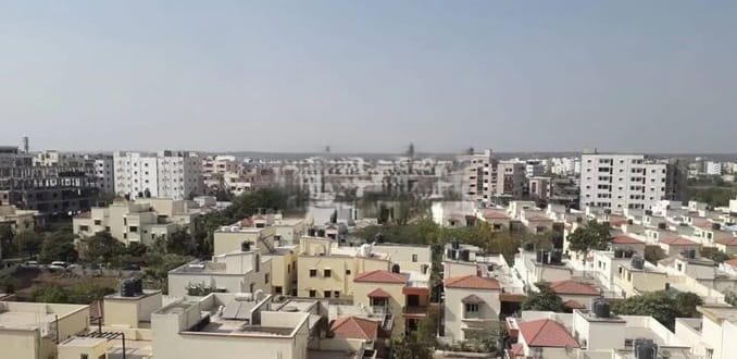
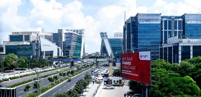
Bangalore, officially Bengaluru, is Karnataka’s capital and one of India’s most important economic, research and innovation centres. What began as a fortified settlement associated with Kempegowda grew through the colonial cantonment era into a major administrative, military and industrial city, and then transformed dramatically during the technology boom. Today Bengaluru is a global centre for information technology, start-ups, biotechnology, aerospace, defence research, electronics, engineering and higher education. Its economy is spread across multiple employment districts rather than one downtown core, from the Central Business District and Peenya to Whitefield, Electronic City, Outer Ring Road, Manyata Tech Park and the airport-side aerospace corridor.
The city’s scale and rapid growth have created a complex urban geography. Historic neighbourhoods such as Basavanagudi, Malleswaram and the Pete area coexist with planned layouts, technology parks, high-rise business corridors and large suburban zones that extend toward Yelahanka, Kengeri, Whitefield and Anekal. Bengaluru’s civic structure also changed significantly in 2025: the Greater Bengaluru Authority now coordinates metropolitan governance through five city corporations. For residents, the most practical way to understand Bengaluru is therefore by corridor and neighbourhood, because travel time is strongly influenced by metro access, ring roads, employment hubs and the exact side of the city.
Quick About Bangalore City Karnataka
| Detail | Information |
| State | Karnataka |
| Official city name | Bengaluru |
| Metropolitan governance | Greater Bengaluru Authority with five city corporations |
| City character | Technology, start-up, aerospace, biotech, education and services hub |
| Main central PIN code | 560001 – Bengaluru GPO |
| Operational Metro network | 96.10 km across Purple, Green and Yellow lines |
| Principal railway stations | KSR Bengaluru City, Yesvantpur and SMVT Bengaluru |
| Airport | Kempegowda International Airport |
| Major road systems | Outer Ring Road, NICE Road, NH 44, NH 48, Mysuru Road/NH 275 |
| Major urban corridors | CBD, Whitefield, Electronic City, ORR, North Bengaluru, Peenya |
Where is Bangalore City Located in Karnataka?
Bengaluru lies in south-eastern Karnataka on the Deccan plateau. Its elevation gives the city a comparatively moderate climate, while its location places it between major road corridors leading toward Mysuru, Chennai, Hyderabad, Tumakuru and southern Tamil Nadu.
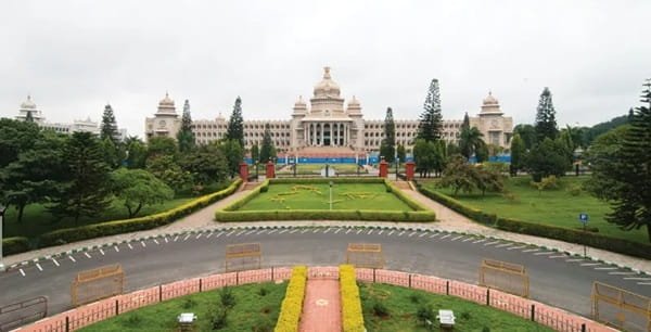
The traditional city centre includes the Pete, Majestic, Vidhana Soudha, Cubbon Park and MG Road areas. Urban growth then spread toward Jayanagar and Banashankari in the south, Indiranagar and Whitefield in the east, Rajajinagar and Peenya in the west, and Hebbal-Yelahanka-Devanahalli in the north.
Because Bengaluru has become a multi-centre metropolis, there is no single ‘best-connected’ locality for everyone. A resident working in Whitefield, Electronic City or Manyata Tech Park can face a very different commute depending on where they live, even when two homes are similar in straight-line distance.
Bangalore City Layout and Major Urban Corridors
- Central Bengaluru: MG Road, Cubbon Park, Vidhana Soudha, Shivajinagar and the traditional CBD combine government, retail, offices and major interchange points.
- East Bengaluru: Indiranagar, KR Puram, Mahadevapura and Whitefield form a major technology and residential corridor with strong Metro access.
- South Bengaluru: Jayanagar, JP Nagar, Banashankari, BTM Layout and Electronic City form a large residential and employment belt.
- North Bengaluru: Hebbal, Yelahanka and the Devanahalli side have grown around airport access, business parks, logistics and aerospace investment.
- West Bengaluru: Rajajinagar, Vijayanagar, Kengeri and Peenya combine mature residential districts, industry and Metro connectivity.
Bengaluru’s employment geography is unusually dispersed. Choosing a home based only on the city’s overall reputation for connectivity can be misleading; corridor-level access to Metro, ORR, NICE Road or a specific tech hub matters far more.
Bangalore City PIN Code
Bengaluru GPO uses PIN code 560001, which covers several central addresses including MG Road, Raj Bhavan, Vasanthanagar and High Court-related postal offices.
The city has a very large number of locality-specific PIN codes. Examples include 560002 for KG Road, 560003 for Malleswaram, 560004 for Basavanagudi, 560034 for Koramangala and 560066 for Whitefield-area addresses depending on the specific post office.
For rental agreements, courier deliveries, GST registration or banking, the exact neighbourhood PIN should always be used. Bengaluru is too large for 560001 to function as a general city-wide postal code.
Road Connectivity
Outer Ring Road
ORR is one of Bengaluru’s most important employment and residential corridors, linking major eastern and southern business zones including Mahadevapura, Marathahalli, Bellandur and the Silk Board side.
NICE Road
NICE Road provides an orbital route across the southern and western edge of the city, useful for movement between Tumakuru Road, Mysuru Road, Kanakapura Road, Bannerghatta Road and Hosur Road.
Major National Highway Corridors
NH 44 connects the city toward the airport and Hyderabad side in the north and Hosur/Chennai-side routes in the south, while NH 48 links toward Tumakuru and Pune-Mumbai direction. Mysuru Road/NH 275 is the main corridor toward Mysuru.
| Road/Route | Useful For |
| Outer Ring Road | Major tech districts and cross-city movement |
| NICE Road | Southern and western orbital travel |
| NH 44 | Airport, Hyderabad direction and Hosur side |
| NH 48 | Tumakuru and western regional travel |
| Mysuru Road / NH 275 | Kengeri, Ramanagara and Mysuru |
Namma Metro Connectivity
Namma Metro is now a major part of Bengaluru’s daily transport network. BMRCL states that 96.10 km of Metro services are operational across three corridors.
The Purple Line runs from Whitefield in the east to Challaghatta in the west, providing a continuous cross-city connection through central Bengaluru. The Green Line runs from Madavara in the north-west to Silk Institute in the south. The Yellow Line adds a 19.15 km connection from RV Road to Delta Electronics Bommasandra, serving the Electronic City and Hosur Road employment corridor.
Even with this expansion, large parts of Bengaluru still require bus or road-based last-mile travel. For most commuters, the most useful question is not simply whether a neighbourhood is ‘near the Metro’ but which line it is on, whether an interchange is required and how far the final office or home is from the station.
Bus, Rail and Airport Access
BMTC operates the city’s extensive bus network and remains essential for areas beyond the Metro. Major bus hubs include Kempegowda Bus Station/Majestic, Shivajinagar, KR Market and satellite terminals in different parts of the city.
KSR Bengaluru City is the principal central railway station, while Yesvantpur Junction and Sir M. Visvesvaraya Terminal at Baiyappanahalli handle many long-distance services. Other suburban stations such as KR Puram, Whitefield, Cantonment, Yelahanka and Kengeri are important for specific corridors.
Kempegowda International Airport is located at Devanahalli in North Bengaluru and operates through Terminal 1 and Terminal 2. Airport travel can be straightforward from Hebbal and Yelahanka but significantly longer from South or East Bengaluru during peak traffic.
Important Areas Around Bangalore City
- Whitefield: One of the city’s largest IT and residential districts, now directly connected by the Purple Line.
- Electronic City: A major technology and industrial district on Hosur Road, served by the Yellow Line.
- Hebbal: A key northern junction and gateway toward the airport, Manyata Tech Park and Yelahanka.
- Koramangala: A central-south residential, start-up and commercial district with strong road access but no direct Metro station yet.
- Peenya: One of Bengaluru’s largest industrial areas, connected by the Green Line.
- Yelahanka: A major northern residential and institutional area with airport-side growth and rail access.
FAQs
Q. Is Bangalore the same as Bengaluru?
Yes. Bengaluru is the official name, while Bangalore remains widely used in English, business names and search queries.
Q. How much of Bengaluru Metro is operational in 2026?
BMRCL states that 96.10 km is operational across the Purple, Green and Yellow corridors.
Q. Does Bangalore have one PIN code?
No. 560001 is the Bengaluru GPO code, but every major neighbourhood has its own postal code.
Q. Which railway station should visitors use?
It depends on the train. KSR Bengaluru City, Yesvantpur and SMVT Bengaluru are the three major long-distance terminals.
Q. Which areas are best for IT employees?
That depends on the job location: Whitefield for eastern IT parks, ORR for Bellandur-Mahadevapura offices, Electronic City for Hosur Road companies and North Bengaluru for Manyata and airport-side jobs.
Q. What should tenants check before choosing a home?
Check real peak-hour travel to the workplace, Metro line and interchange needs, bus access, water and civic services, and the exact city-corporation jurisdiction under the new GBA structure.