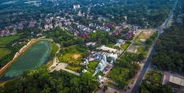
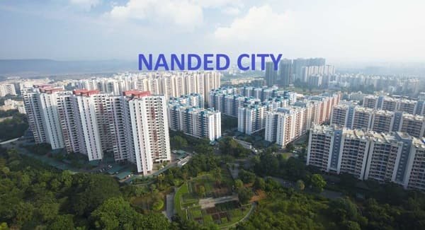
Nanded City is a large integrated township on Sinhagad Road in southwest Pune. Developed by Nanded City Development & Construction Company, it was planned as a self-contained residential community with apartment clusters, schools, shopping facilities, sports areas, landscaped open spaces and internal civic infrastructure. Its scale gives it a different character from a single housing society: residents can complete many everyday activities within the township itself.
The location is closely tied to the Sinhagad Road corridor and the western bypass of Pune. This gives residents access toward Swargate and central Pune on one side and toward Warje, NH 48 and western employment areas on the other. At the same time, traffic on Sinhagad Road remains an important factor in daily travel, so the exact route and time of day matter.
Quick About Nanded City Pune
| Detail | Information |
| City | Pune, Maharashtra |
| Main road | Sinhagad Road |
| Development type | Integrated residential township |
| Approximate scale | About 700 acres |
| Main PIN code | 411041 |
| Highway access | NH 48 / Mumbai-Bengaluru bypass via connecting roads |
| Public transport | PMPML buses and local road transport |
| Rail access | Pune Junction and other city stations via road |
| Nearby areas | Dhayari, Narhe, Warje, Ambegaon, Khadakwasla |
Where is Nanded City Located in Pune?
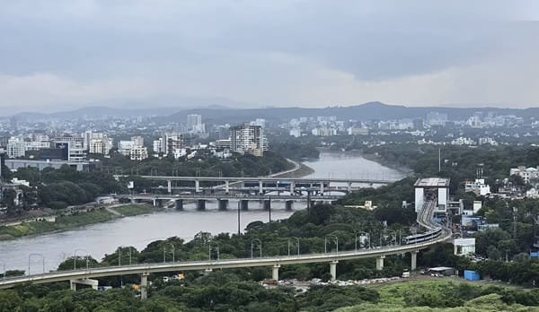
Nanded City is located off Sinhagad Road in the Nanded area of Pune, southwest of the traditional city centre. The township lies near the Mutha River belt and is positioned between dense Sinhagad Road neighbourhoods and the western bypass side of Pune.
The location is useful for people whose regular destinations are in Sinhagad Road, Kothrud, Warje, Narhe, Ambegaon or other western and southwestern parts of Pune. Travel to Hinjawadi is possible through NH 48 and bypass routes, although peak traffic can make journey times variable.
The township is large enough to have several residential clusters and internal destinations. Visitors should use the exact project or cluster name when booking a cab because simply entering ‘Nanded City’ may lead to a different gate.
Township Layout and Daily-use Infrastructure
- Residential clusters: The township contains multiple apartment and housing clusters rather than a single gated complex.
- Education: Schools within or close to the township reduce the need for some daily school trips outside the development.
- Retail and services: Shopping and daily-use facilities are planned within the broader township ecosystem.
- Sports and open spaces: Recreation grounds, landscaped areas and large open spaces are part of the township’s planning.
The internal road network is designed to distribute traffic among clusters, but the main external pressure point remains the connection to Sinhagad Road and the wider Pune road network.
Nanded City Pune PIN Code
Nanded City uses PIN code 411041 for its Sinhagad Road address. This code is commonly used across the township’s residential and project addresses.
The wider Sinhagad Road area contains several adjoining neighbourhoods, and some nearby localities can use different postal codes. For deliveries or formal documents, the cluster, tower and building name should be written along with the PIN.
Property buyers and tenants should use the address printed on their agreement, maintenance bill or official society communication rather than assuming that every nearby project carries the Nanded City code.
Road Connectivity
Sinhagad Road
This is the township’s primary urban corridor, connecting it toward Dhayari, Anand Nagar, Swargate and central Pune. Peak-hour traffic can be heavy, so short map distances do not always translate into short travel times.
NH 48 / Western Bypass
Connections toward the Mumbai-Bengaluru highway help residents reach Warje, Katraj, Hinjawadi-side routes and other western parts of the Pune metropolitan area.
Warje and Kothrud Side
Road links through the bypass and local connector roads provide access toward Warje, Karve Nagar and Kothrud, which are important education, work and shopping destinations.
| Road/Route | Useful For |
| Sinhagad Road | Swargate, Anand Nagar and central Pune |
| NH 48 / bypass | Warje, Katraj and western Pune routes |
| Dhayari Road links | Neighbouring residential areas and local services |
| Warje connections | Kothrud, Karve Nagar and western city access |
| Internal township roads | Residential clusters, schools and retail areas |
Metro and Public Transport Connectivity
Nanded City does not have an operational Pune Metro station inside the township. For most residents, buses, cabs, two-wheelers and private cars remain the main modes for the first part of a journey.
PMPML services connect the Sinhagad Road belt with other parts of Pune, and the township has developed internal bus access for residents. This is useful for people who do not want to depend entirely on private vehicles.
Metro travel can still be combined with road transport by reaching an operational station elsewhere in Pune, but the value of that option depends on the final destination. It is not a direct walk-to-metro locality.
Bus, Rail and Airport Access
PMPML buses are important for daily connectivity along Sinhagad Road and toward major city hubs. Autos and app cabs are widely available, although waiting time can vary inside large residential clusters during busy periods.
Pune Junction is the main long-distance railway station for the city and can be reached by road through central Pune. Depending on the train and destination, residents may also use other Pune suburban or city stations.
Pune International Airport is across the city from Nanded City. Airport journeys should be planned with a substantial traffic buffer, especially during office hours or evening congestion.
Nearby Areas Around Nanded City Pune
- Dhayari: A dense residential locality immediately associated with the Sinhagad Road growth corridor.
- Narhe: A residential and commercial area near the NH 48 bypass, useful for highway access.
- Warje: An important western Pune neighbourhood with strong road links toward Kothrud and the bypass.
- Ambegaon: A growing residential belt on the Katraj and Sinhagad Road side of southwest Pune.
- Khadakwasla: A well-known area farther along the Sinhagad route, associated with the dam and western outskirts.
- Anand Nagar: A developed Sinhagad Road neighbourhood on the route toward central Pune.
FAQs
Q. Is Nanded City the same as Nanded city in Maharashtra’s Marathwada region?
No. This article is about Nanded City township on Sinhagad Road in Pune. Nanded in Marathwada is a separate city hundreds of kilometres away.
Q. Does Nanded City have a metro station?
No operational metro station is located inside the township. Road-based public transport remains the main local option.
Q. Is Nanded City close to NH 48?
It has road access toward the western bypass/NH 48, which is useful for Warje, Katraj and longer cross-city journeys.
Q. Is the township only residential?
Residential use is the main character, but the larger development also includes education, retail, recreation and daily-use infrastructure.
Q. Which route matters most for daily commuting?
Sinhagad Road is the main urban approach. For western Pune and highway travel, the NH 48/bypass connection is also important.
Q. What should tenants check before choosing a cluster?
Check the exact gate, distance to the main road, school or office route, bus availability and evening traffic rather than comparing projects only by township name.