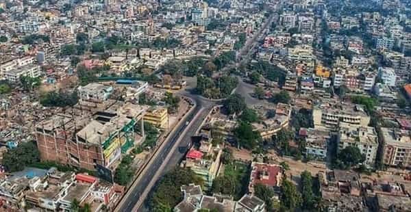
Patna is the capital and largest urban centre of Bihar, stretching along the southern bank of the Ganga as the state’s principal hub for government, education, healthcare, commerce and regional transport. The modern city combines one of South Asia’s oldest urban histories with a rapidly expanding metropolitan landscape: ancient Pataliputra developed here as the capital of the Mauryan and later Gupta empires, while today’s Patna contains major administrative institutions, universities, hospitals, markets, business districts and dense residential neighbourhoods.
Urban growth now extends far beyond the traditional centre around Gandhi Maidan, Fraser Road, Exhibition Road and the old city. Western Patna has expanded toward Bailey Road, Saguna More and Danapur, while eastern growth continues through Kankarbagh, Bhootnath, Zero Mile and the New ISBT side. Bridges across the Ganga connect Patna with Hajipur and North Bihar, and the city’s transport mix now includes rail, airport services, buses, major urban roads and a partially operational Metro network.
Quick About Patna City Bihar
| Detail | Information |
| State | Bihar |
| Status | State capital and district headquarters |
| River setting | South bank of the Ganga |
| City character | Administrative, educational, healthcare, commercial and transport hub |
| Main central PIN code | 800001 (Patna GPO) |
| Main railway station | Patna Junction |
| Airport | Jay Prakash Narayan International Airport |
| Metro status in October 2026 | Partially operational; priority Blue Line section open |
| Operational Metro section | New ISBT to Malahi Pakri, with four passenger stations currently open |
| Major road corridors | Bailey Road/Jawaharlal Nehru Marg, NH-31, Atal Path, Ganga Path and bridge approaches |
| Nearby areas | Danapur, Phulwari Sharif, Hajipur, Bihta, Fatuha, Sampatchak |
Where is Patna City Located in Bihar?
Patna is located in central Bihar on the southern bank of the Ganga and serves as the headquarters of Patna district as well as the capital of the state. Its river-side position has shaped the city for centuries, from ancient Pataliputra to the modern administrative capital.
The urban area is long and linear because much of the city follows the Ganga. Central Patna includes Gandhi Maidan, Dak Bungalow, Fraser Road, Exhibition Road and the Secretariat side. Westward development extends through Boring Road, Raja Bazar, Bailey Road, Saguna More and Danapur, while eastern Patna includes Kankarbagh, Rajendra Nagar, Bhootnath, Zero Mile and Patna City/Patna Sahib.
Patna is also closely linked with neighbouring urban areas. Danapur is effectively part of the continuous western built-up region, Phulwari Sharif lies to the south-west, and Hajipur across the Ganga is connected by major bridges. These adjoining areas may have separate municipal or postal identities despite functioning as part of the wider metropolitan travel zone.
Patna City Layout and Main Urban Corridors
- Gandhi Maidan-Dak Bungalow core: The central administrative and commercial zone, with major offices, hotels, markets and access to the old city and riverfront.
- Bailey Road-Raja Bazar-Saguna More: A major western growth corridor with government institutions, hospitals, offices, apartments and heavy daily commuter traffic.
- Kankarbagh-Rajendra Nagar side: One of Patna’s largest residential and commercial belts, closely linked with railway, Metro construction and eastern city roads.
- Patna City / Patna Sahib: The historic eastern part of the urban area, known for dense traditional neighbourhoods, religious sites and old commercial streets.
- Bhootnath-Zero Mile-New ISBT corridor: A rapidly developing eastern transport and residential zone that now contains the operational priority section of Patna Metro.
Patna’s elongated form means commuting convenience depends strongly on east-west location. A home in Danapur and a workplace near Zero Mile can involve a major cross-city trip even when both are within the metropolitan area.
Patna City PIN Code
India Post lists Patna GPO under PIN code 800001, which is the main central postal reference for the city.
Patna has many additional postal zones because of its size. Rajendra Nagar uses 800016, Sadaquat Ashram 800010, Phulwari Sharif 801505 and numerous other neighbourhoods have their own PIN codes.
For courier delivery, university applications, bank KYC, company registration or property documents, always use the PIN assigned to the exact locality rather than applying 800001 to the entire urban area.
Road Connectivity
Bailey Road / Jawaharlal Nehru Marg
This is one of Patna’s most important east-west urban corridors, connecting central government areas with Raja Bazar, airport-side roads, Saguna More and the Danapur direction.
NH-31 and Eastern Patna Corridors
NH-31 and connecting roads serve Patna, Fatuha, Bakhtiarpur and the eastern district side. They are important for regional road travel as well as the city’s eastern residential and industrial growth.
Ganga Bridges and River-side Roads
Mahatma Gandhi Setu and other Ganga crossings connect Patna with Hajipur and North Bihar. Atal Path and Ganga Path have added newer high-capacity corridors that help redistribute some traffic away from older central roads.
| Road/Route | Useful For |
| Bailey Road / J.N. Marg | Central Patna, airport side, Raja Bazar, Saguna More and Danapur |
| NH-31 | Eastern Patna, Fatuha, Bakhtiarpur and regional travel |
| Mahatma Gandhi Setu approaches | Hajipur and North Bihar |
| Atal Path | Faster movement across parts of western and central Patna |
| Ganga Path | River-side east-west movement and access to central neighbourhoods |
Patna Metro Connectivity
Patna Metro is partially operational as of October 2026. The active section is on Corridor II, commonly described as the Blue Line priority corridor, between New ISBT and Malahi Pakri.
Passenger service is currently available at New ISBT, Zero Mile, Bhootnath and Malahi Pakri. Khemni Chak is on the same corridor but is still being completed as an interchange station and is not yet fully open for passenger use in October 2026.
The rest of the network remains under construction. Future sections are planned through Rajendra Nagar, University, PMCH, Gandhi Maidan, Patna Junction, Mithapur, Raja Bazar, Patliputra and Danapur. Residents should therefore separate currently operational Metro access from stations that are still construction sites.
Bus, Rail and Airport Access
Patna Junction is the city’s principal railway station and has direct rail links with major Indian cities including Delhi, Mumbai, Kolkata, Guwahati, Varanasi, Bengaluru, Lucknow and Chennai. Other important stations include Rajendra Nagar Terminal, Patliputra Junction, Danapur and Patna Sahib, depending on the train and the passenger’s location.
Jay Prakash Narayan International Airport serves Patna from the western-central part of the city, close to Bailey Road and the government-institutional belt. Road travel to the airport is convenient from western Patna but can take longer from eastern areas such as Patna City or Zero Mile during peak traffic.
Bus services operate from the New ISBT and other city terminals for destinations across Bihar and neighbouring states. For North Bihar routes, bridge traffic and the chosen Ganga crossing can significantly affect journey time.
Nearby Areas Around Patna City
- Danapur: A major western urban centre that is physically continuous with Patna and important for rail, defence and residential growth.
- Phulwari Sharif: A large adjoining town south-west of central Patna, close to the airport and major institutions.
- Hajipur: The principal city across the Ganga in Vaishali district, connected with Patna by major road and rail bridges.
- Bihta: A fast-growing town west of Patna associated with education, industry and regional development.
- Fatuha: An industrial and transport town east of Patna on important road and rail routes.
- Sampatchak: A developing southern and south-eastern suburban area linked with expanding Patna residential corridors.
FAQs
Q. Is Patna Metro fully operational in 2026?
No. Only the priority Blue Line section from New ISBT to Malahi Pakri is operational. Most of the planned network is still under construction.
Q. Which Patna Metro stations are open now?
As of October 2026, passenger service is available at New ISBT, Zero Mile, Bhootnath and Malahi Pakri. Khemni Chak is not yet fully open for passengers.
Q. Does all of Patna use PIN code 800001?
No. 800001 is Patna GPO’s code, but the city has many locality-specific PIN codes.
Q. Which railway station should travellers use in Patna?
Patna Junction is the main station, but Rajendra Nagar Terminal, Patliputra Junction, Danapur and Patna Sahib can be more convenient depending on the train and neighbourhood.
Q. Is Patna City the same as Patna Sahib?
Not exactly. Patna City or Patna Sahib commonly refers to the historic eastern part of the larger Patna urban area, while Patna city as a whole extends much farther west.
Q. Which side of Patna is more convenient for the airport?
Western and central areas such as Bailey Road, Raja Bazar and nearby neighbourhoods are generally more convenient for airport access than the far eastern parts of the city.