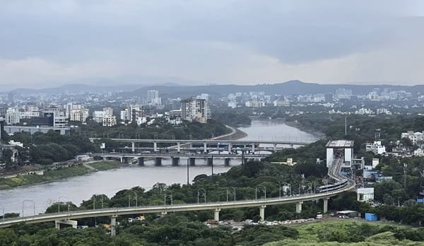
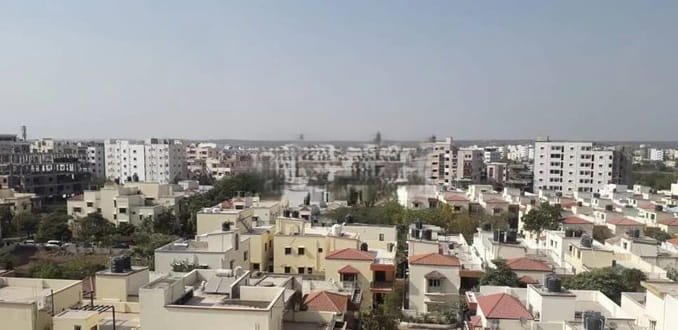
Ghazipur is an important city in eastern Uttar Pradesh and the administrative headquarters of Ghazipur district. Set on the banks of the Ganga, the city has long served as a regional centre for government services, education, healthcare, agriculture and trade across the eastern Purvanchal belt. Its urban identity is closely tied to the river, the old administrative quarters, busy market areas and the railway network that links Ghazipur with Varanasi, Ballia, Bihar and major cities farther away.
The city also has a distinctive historical and economic profile. Ghazipur is associated with the colonial-era Tomb of Lord Cornwallis, a long tradition of rose cultivation and rose-water production in the district, and the Government Opium and Alkaloid Factory, one of India’s specialised government facilities for processing licit opium and pharmaceutical alkaloids. In recent years, the Purvanchal Expressway has strengthened Ghazipur’s road position within eastern Uttar Pradesh, while Varanasi remains the nearest major metropolitan and aviation centre.

Quick About Ghazipur City Uttar Pradesh
| Detail | Information |
| State | Uttar Pradesh |
| Region | Eastern Uttar Pradesh / Purvanchal |
| District | Ghazipur |
| Urban administration | Nagar Palika Parishad, Ghazipur |
| City character | Administrative, agricultural-trade, educational and regional service centre |
| Main central PIN code | 233001 |
| Main railway station | Ghazipur City Railway Station |
| Nearest major airport | Lal Bahadur Shastri International Airport, Varanasi |
| Major expressway link | Purvanchal Expressway via the Ghazipur district end |
| Major road directions | Varanasi, Ballia, Mau, Zamania and Bihar side |
| Nearby areas | Rauza, Lanka, Mahuabagh, Gorabazar, Peer Nagar, Nandganj-side corridor |
Where is Ghazipur City Located in Uttar Pradesh?
Ghazipur lies in the eastern part of Uttar Pradesh within the Varanasi Division. The city is positioned on the Ganga and functions as the headquarters of Ghazipur district, a large agricultural district bordering Bihar on its eastern side. Varanasi lies to the west and is the most important nearby metropolitan reference for higher-order healthcare, aviation, tourism and long-distance business travel.
The city has developed around older administrative and market neighbourhoods, the railway corridor and the river-side road network. Areas such as Lanka, Mahuabagh, Rauza, Gorabazar and Peer Nagar are common urban reference points, while development also extends along the roads toward Varanasi, Nandganj, Zamania and Ballia.
Ghazipur should be distinguished from the much larger district bearing the same name. A property or institution described simply as being in ‘Ghazipur’ may be inside Ghazipur city, in another town such as Zamania or Mohammadabad, or in a rural block. For travel, postal use and civic services, the exact locality is therefore important.
Ghazipur City Layout and Main Urban Areas
- Lanka and central market side: A busy commercial and transport zone with shops, institutions and road movement toward major parts of the city.
- Mahuabagh: A prominent mixed-use locality with commercial activity, residential areas and access toward central Ghazipur.
- Gorabazar: An established urban neighbourhood associated with hospitals, institutions and city services.
- Rauza: A growing residential and commercial area on an important city approach road.
- Peer Nagar and river-side neighbourhoods: Dense residential and local-market areas that connect the old city fabric with the Ganga-side parts of Ghazipur.
Ghazipur is more compact than a large metro, but daily convenience still varies considerably by locality. A home near the station or Lanka market has a different travel pattern from one on an outer Varanasi, Nandganj or Zamania approach road.
Ghazipur City PIN Code
India Post lists Ghazipur Head Post Office under PIN code 233001, which is the main central postal reference for Ghazipur city.
The wider district uses many additional PIN codes. Nearby towns, suburban edges and rural areas therefore should not be addressed with 233001 simply because they fall within Ghazipur district.
For courier delivery, bank KYC, property documents, school records or government applications, use the complete locality and post-office PIN printed on the official address. This is especially important where an institution lies outside the central municipal area.
Road Connectivity
Varanasi-Ghazipur Corridor
The Varanasi side is one of Ghazipur’s most important road directions because it connects the city with the nearest large urban centre, international airport, major hospitals and tourism economy. Road traffic can become heavier around market and town approaches.
Purvanchal Expressway
The Purvanchal Expressway ends in Ghazipur district near Haidaria and provides a high-speed regional route toward Mau, Azamgarh, Sultanpur and Lucknow. Reaching it from central Ghazipur requires a road transfer, so it should be viewed as a regional expressway connection rather than an inner-city road.
Ballia, Zamania and Bihar-side Roads
Roads east and south-east from Ghazipur connect with Ballia, Zamania, Buxar-side routes and the Bihar border. These corridors are important for regional trade, family travel and district-level commuting.
| Road/Route | Useful For |
| Varanasi road | Varanasi, airport access and western regional travel |
| Purvanchal Expressway connection | Mau, Azamgarh, Sultanpur and Lucknow direction |
| Ballia road | Eastern Uttar Pradesh and Ballia-side travel |
| Zamania/Bihar-side routes | Zamania, Buxar direction and cross-border regional movement |
| Nandganj-side road | Local and regional movement toward western district areas |
Public Transport Connectivity
Ghazipur does not have a metro system. Local travel depends on buses, autos, e-rickshaws, taxis, two-wheelers and private vehicles.
Autos and e-rickshaws are widely used for short trips between the railway station, Lanka, Mahuabagh, Gorabazar, hospitals and residential neighbourhoods. Government and private buses connect the city with Varanasi, Ballia, Mau, Azamgarh, Lucknow and other regional destinations.
For daily travel within the city, road conditions around the central market and station areas matter more than distance alone. Peak market hours, school timings and festival periods can slow short urban trips.
Rail and Airport Access
Ghazipur City Railway Station is the main rail gateway for the city. The district administration notes that Ghazipur is connected by rail with major destinations including New Delhi, Mumbai, Kolkata, Lucknow, Varanasi and Ballia. Dildarnagar, elsewhere in Ghazipur district, is another important railway point on the Delhi-Howrah main line.
The nearest major airport is Lal Bahadur Shastri International Airport at Babatpur, Varanasi. The Ghazipur district administration places it at about 70 km from Ghazipur, so air passengers need a substantial road transfer.
For many travellers, the most practical long-distance plan is rail directly from Ghazipur where a suitable train is available, or road travel to Varanasi for a wider choice of flights and rail services.
Nearby Areas Around Ghazipur City
- Rauza: A major residential and commercial locality on an important city approach corridor.
- Lanka: One of the busiest central urban references for markets, institutions and local transport.
- Mahuabagh: A mixed residential-commercial area with strong access to the central city.
- Gorabazar: An established neighbourhood associated with hospitals, institutions and everyday services.
- Nandganj: A nearby town west of Ghazipur on the Varanasi-side regional corridor.
- Zamania: An important town south-east of Ghazipur, connected by road and rail and useful for Bihar-side travel.
FAQs
Q. Is Ghazipur City the same as Ghazipur district?
No. Ghazipur city is the district headquarters and municipal urban centre, while Ghazipur district contains many other towns, villages and blocks.
Q. Does Ghazipur have an airport?
Ghazipur does not have a major commercial airport. The nearest large airport is Lal Bahadur Shastri International Airport at Varanasi.
Q. Is the Purvanchal Expressway inside Ghazipur city?
No. The expressway ends in Ghazipur district near Haidaria. Central-city travellers need a road connection to reach the expressway.
Q. Which railway station is best for Ghazipur city?
Ghazipur City Railway Station is the principal station for the city. Dildarnagar is another important district station on the Delhi-Howrah main line.
Q. Does all of Ghazipur use PIN code 233001?
No. 233001 is the Ghazipur Head Post Office code, while the wider district contains many other postal zones.
Q. What is Ghazipur especially known for?
The city and district are known for their Ganga-side setting, historical associations, rose cultivation, regional agriculture and the Government Opium and Alkaloid Factory.