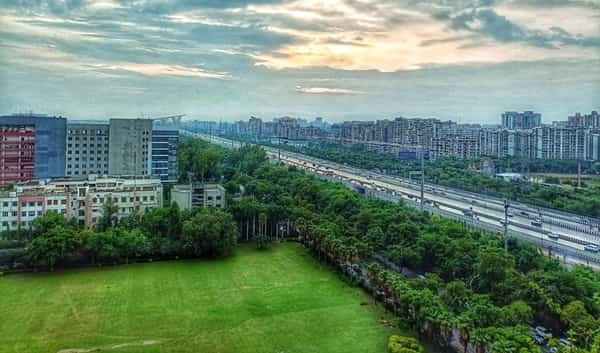
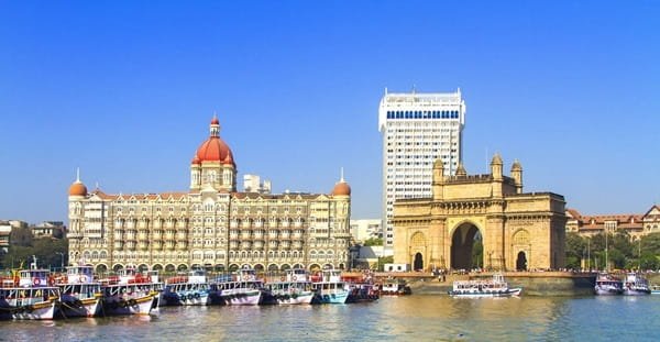
Mumbai is India’s financial capital, Maharashtra’s principal metropolis and one of the world’s most intensely connected coastal cities. Its modern identity grew from a historic port city into the country’s leading centre for banking, capital markets, corporate headquarters, entertainment, media, shipping, professional services and a vast informal economy. South Mumbai contains many of India’s best-known financial and administrative institutions, while the suburban belt carries a much larger share of the city’s population, housing, offices, film industry and daily commuter movement. The result is not a single-centre city but a long north-south urban system tied together by suburban rail, Metro lines, expressways, arterial roads and sea links.
Mumbai’s geography explains much of its transport pattern. The historic island city stretches from Colaba and Fort north through Dadar, while the western and eastern suburbs continue toward Borivali, Dahisar, Mulund and beyond into the wider Mumbai Metropolitan Region. Employment is similarly distributed: Nariman Point and Fort remain major business areas, but Bandra-Kurla Complex, Lower Parel, Andheri, Powai, Goregaon and other suburban districts are equally important. In recent years, the fully operational underground Aqua Line, new Metro extensions, the Coastal Road and Atal Setu have further changed how different parts of Mumbai connect with each other and with Navi Mumbai.
Quick About Mumbai City Maharashtra
| Detail | Information |
| State | Maharashtra |
| City administration | Brihanmumbai Municipal Corporation |
| Metropolitan region | Mumbai Metropolitan Region |
| City character | Financial, commercial, port, media, entertainment and services capital |
| Main central PIN code | 400001 – Mumbai GPO/Fort |
| Mass transit | Suburban rail, Metro, Monorail, BEST buses |
| Major Metro lines in service | Lines 1, 2A, 3, 7 plus operational sections of 2B and 9 |
| Principal rail terminals | CSMT, Mumbai Central, Bandra Terminus and Lokmanya Tilak Terminus |
| Airport | Chhatrapati Shivaji Maharaj International Airport |
| Major regional links | Western/Eastern Express Highways, Coastal Road, Eastern Freeway, Atal Setu |
Where is Mumbai City Located in Maharashtra?
Mumbai lies on Maharashtra’s Konkan coast facing the Arabian Sea. The municipal city extends from South Mumbai through the western and eastern suburbs to the Dahisar-Mulund side, while the larger Mumbai Metropolitan Region continues into Thane, Navi Mumbai, Mira-Bhayandar, Kalyan-Dombivli and other surrounding cities.
South Mumbai contains Colaba, Fort, Nariman Point, Churchgate and the historic administrative-financial core. Central Mumbai includes areas such as Byculla, Parel, Dadar and Worli, while the suburbs expand northward through Bandra, Andheri, Goregaon, Malad, Kandivali and Borivali on the west and Kurla, Ghatkopar, Vikhroli, Bhandup and Mulund on the east.
This elongated geography makes north-south travel especially important. Cross-city convenience depends heavily on which suburban railway line, Metro corridor or express highway serves the origin and destination.
Mumbai City Layout and Major Urban Zones
- South Mumbai: Fort, Colaba, Nariman Point, Churchgate and Marine Drive form the historic financial, administrative and heritage core.
- Central Mumbai: Dadar, Parel, Lower Parel, Worli and Byculla have transformed from older industrial districts into dense residential, commercial and high-rise business zones.
- Western suburbs: Bandra, Andheri, Goregaon, Malad, Kandivali and Borivali combine major residential, film, retail and office districts.
- Eastern suburbs: Kurla, Ghatkopar, Powai, Vikhroli, Bhandup and Mulund form a large residential and employment corridor tied closely to Central Railway and eastern highways.
- Bandra-Kurla Complex: BKC is one of the city’s most important modern business districts and a major node on the underground Metro Line 3.
Mumbai’s neighbourhood identity is extremely important because the city is long, dense and highly corridor-dependent. Two areas within the same municipal city can have very different commute patterns depending on access to suburban rail, Metro interchanges and east-west connectors.
Mumbai City PIN Code
Mumbai GPO in Fort uses PIN code 400001, which is the main central postal reference for the historic business district and several nearby government and commercial addresses.
Mumbai has hundreds of locality-specific postal codes. Colaba, Dadar, Bandra, Andheri, Powai, Borivali, Ghatkopar and every major suburb use their own PINs, often with multiple codes within the same broad neighbourhood.
For property papers, courier delivery, bank KYC, company registration or hotel bookings, use the exact locality PIN. A 400001 address should not be used simply because the destination is somewhere in Mumbai.
Road Connectivity
Western Express Highway
The Western Express Highway is one of Mumbai’s main north-south road spines, linking the Bandra-Andheri-Goregaon-Borivali-Dahisar corridor and providing access toward the airport and western suburban districts.
Eastern Express Highway and Eastern Freeway
The Eastern Express Highway serves the eastern suburbs and links toward Thane, while the Eastern Freeway provides a faster connection between South Mumbai and the Chembur side.
Coastal Road and Atal Setu
The Mumbai Coastal Road has added high-capacity movement along the western edge of South/Central Mumbai, while Atal Setu connects Sewri with Navi Mumbai across the harbour, transforming access toward Panvel and Navi Mumbai-side infrastructure.
| Road/Route | Useful For |
| Western Express Highway | Western suburbs, airport and Dahisar direction |
| Eastern Express Highway | Eastern suburbs and Thane |
| Eastern Freeway | South Mumbai to Chembur side |
| Coastal Road | South/Central Mumbai western seafront corridor |
| Atal Setu | Sewri to Navi Mumbai and Panvel-side regional travel |
Mumbai Metro Connectivity
Mumbai’s Metro network has expanded sharply. Line 1 connects Versova, Andheri and Ghatkopar; Line 2A serves the Dahisar-Andheri West corridor; and Line 7 runs along the Andheri East-Dahisar East side.
The biggest recent change is the Aqua Line, Mumbai Metro Line 3. The entire 33.5 km underground corridor from Cuffe Parade to Aarey JVLR was dedicated in October 2025, bringing Metro access directly to South Mumbai, BKC, both airport terminals, SEEPZ and major central districts.
Expansion continued in 2026. Phase I of Line 9 between Dahisar East and Kashigaon became operational in April 2026, while initial sections of Line 2B in the Chembur-Mandale side also entered service. Other corridors remain under construction, so commuters should distinguish operational segments from future alignments.
Bus, Rail and Airport Access
Mumbai’s suburban railway remains the backbone of daily travel. Western Railway and Central Railway together operate more than 3,200 suburban services on a normal day, carrying commuters across the Western, Central and Harbour corridors.
Major long-distance terminals include Chhatrapati Shivaji Maharaj Terminus, Mumbai Central, Bandra Terminus and Lokmanya Tilak Terminus. Dadar is also a major interchange for suburban and long-distance travel, while many outer suburban stations serve regional trains.
Chhatrapati Shivaji Maharaj International Airport serves Mumbai through Terminals 1 and 2. The Aqua Line now gives the airport direct Metro access, while road approaches include the Western Express Highway and key east-west connectors.
Important Areas Around Mumbai City
- Bandra-Kurla Complex: A major modern financial and corporate district with direct Aqua Line access.
- Andheri: One of Mumbai’s largest commercial and residential hubs and a major suburban rail-Metro interchange area.
- Powai: An eastern-suburban business, education and residential district close to IIT Bombay and major technology offices.
- Lower Parel: A former mill district transformed into a major office, retail and high-rise residential centre.
- Borivali: A major northern suburban residential and rail hub with Metro access and proximity to Sanjay Gandhi National Park.
- Navi Mumbai: A separate planned city across the harbour, now much more directly connected through Atal Setu and regional transport links.
FAQs
Q. Is Mumbai City the same as the Mumbai Metropolitan Region?
No. Mumbai city is governed by BMC, while the Mumbai Metropolitan Region includes several separate cities such as Thane, Navi Mumbai, Mira-Bhayandar and Kalyan-Dombivli.
Q. Is the full Mumbai Metro Aqua Line operational?
Yes. The entire 33.5 km Line 3 from Cuffe Parade to Aarey JVLR was dedicated in October 2025 and is operational.
Q. Does Mumbai have one PIN code?
No. 400001 is the Mumbai GPO/Fort code, but every major neighbourhood has its own postal code.
Q. What is the main public transport mode in Mumbai?
Suburban rail remains the city’s backbone, supported by Metro lines, BEST buses, Monorail, taxis and app-based cabs.
Q. Which railway terminal should long-distance passengers use?
It depends on the train. CSMT, Mumbai Central, Bandra Terminus and Lokmanya Tilak Terminus serve different routes and operators.
Q. What should newcomers consider before choosing where to live?
Choose based on the workplace corridor, suburban rail or Metro line, east-west connectivity and door-to-door peak-hour commute rather than only the neighbourhood’s prestige or straight-line distance.