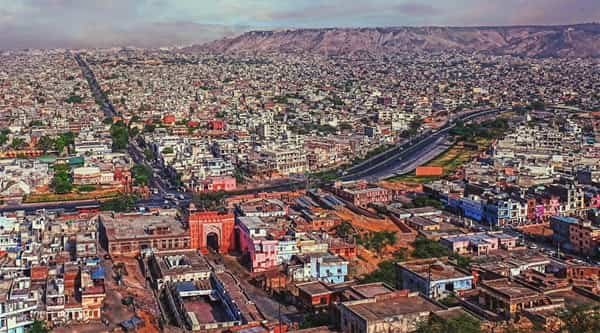
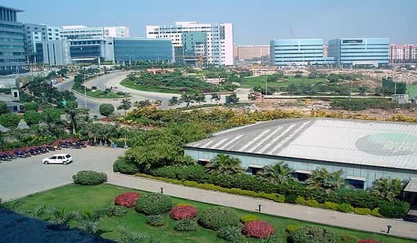
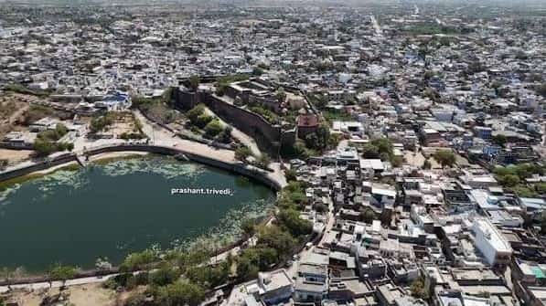
Sojat City is a historic municipal town in Pali district of Rajasthan’s Marwar region. It is especially known for its mehndi or henna trade, which has given the town a commercial identity beyond its size. Agricultural markets, henna-processing businesses, local retail, government offices and educational institutions support the town, while Sojat Fort and old temples reflect its longer history. The Sukri River and the dry Marwar landscape also shape the setting around the city.
The city lies on NH 162 between the Pali-Marwar side and routes leading toward Beawar and the eastern Marwar belt. Sojat Road railway station, located outside the main municipal centre, is the principal rail access point and lies on the important Jaipur-Ahmedabad railway corridor. Pali is the nearest larger district centre, while Jodhpur provides the nearest major commercial airport. This combination makes road transport important for everyday travel even when visitors arrive in the region by train.
Quick About Sojat City Rajasthan
| Detail | Information |
| State | Rajasthan |
| District | Pali |
| Region | Marwar |
| City character | Municipal, agricultural-trade and henna-processing centre |
| Known for | Sojat mehndi / henna |
| Main PIN code | 306104 |
| Main highway | NH 162 |
| Nearest railway station | Sojat Road Railway Station |
| Railway division | Ajmer Division, North Western Railway |
| Nearest major airport | Jodhpur Airport |
| Nearby places | Sojat Road, Pali, Bagri Nagar, Chandawal, Jaitaran |
Where is Sojat City Located in Rajasthan?
Sojat City is located in Pali district in western Rajasthan’s Marwar region. It lies on the Sukri River and is positioned between the larger urban centres of Pali and the Beawar side, with NH 162 providing the city’s main road connection.
The municipal area is compact, with the old city, local markets, fort-side neighbourhoods, government offices and newer roadside development forming the main urban pattern. Henna trading and processing activity is spread through the city and surrounding agricultural belt rather than being limited to one industrial estate.
Sojat City and Sojat Road are related but separate places. Sojat Road is the railway-town location serving the main rail line, while Sojat City is the municipal and commercial centre reached by road from the station. This distinction matters when booking a train, cab or hotel.
Sojat City Layout and Main Areas
- Old city and Sojat Fort side: The historic core includes older markets, religious sites and neighbourhoods around the fort and traditional town centre.
- NH 162 corridor: The national highway supports newer roadside development, colleges, government facilities and intercity traffic.
- Mehndi market and processing areas: Henna trading, processing and associated businesses are an important part of the local commercial landscape.
- Pali Road side: The western approach connects the city with Pali and wider district-level services.
- Sojat Road approach: This road is important for passengers travelling between Sojat City and the main railway station at Sojat Road.
Sojat is small enough for most local trips to be short, but the railway station is outside the main city. Visitors arriving by train should therefore include the station-to-city road transfer in their travel plan.
Sojat City PIN Code
The main PIN code for Sojat City is 306104. Sojat Sub Post Office and Sojat Bazar use this postal zone, and the code also covers several surrounding villages in Sojat tehsil.
Nearby places can have different codes even when they use Sojat as the nearest town or tehsil reference. Sojat Road, rural villages and outer settlements should be checked separately before using 306104.
For a correct postal address, include the locality or road name, Sojat City, Pali district, Rajasthan and the PIN listed on the specific property or institution.
Road Connectivity
NH 162
National Highway 162 passes through Sojat City and is its most important regional road. It connects the city with Pali and extends through the Marwar region toward other Rajasthan destinations.
Pali Road
The Pali-side route is important for district administration, hospitals, larger markets and onward travel toward Jodhpur and western Rajasthan.
Sojat Road and Local Rural Roads
The road to Sojat Road railway station is essential for rail passengers, while local roads connect henna-growing villages and neighbouring settlements with the city market.
| Road/Route | Useful For |
| NH 162 | Pali, Marwar regional routes and through traffic |
| Pali Road | District headquarters and Jodhpur-side connections |
| Sojat Road link | Main railway station access |
| Bagri Nagar/Chandawal roads | Nearby towns and rural trade movement |
| Local market roads | Fort area, mehndi businesses and civic services |
Public Transport Connectivity
Sojat City does not have a metro system. Local travel is mainly by auto, shared vehicle, bus, taxi, two-wheeler and private car.
Rajasthan Roadways and private bus services connect Sojat with Pali, Jodhpur-side routes, Beawar-side towns and other nearby destinations. For many short regional journeys, bus travel is more direct than travelling first to the railway station.
Passengers using Sojat Road railway station need a separate road transfer to the municipal centre. Autos, taxis and local vehicles are therefore an important part of the city’s practical public-transport network.
Bus, Rail and Airport Access
Sojat Road Railway Station is the principal rail gateway for Sojat City. Indian Railways records place it under the Ajmer Division of North Western Railway. The station lies on the Jaipur-Ahmedabad rail corridor and handles passenger, express and other train services.
Road transport remains central because the railway station is not inside the main Sojat City market area. Buses and private vehicles connect the city with Pali, Jaitaran, Beawar-side routes and surrounding rural areas.
Jodhpur Airport is the nearest major commercial airport. Travellers arriving by air normally continue to Sojat by road, with Pali and the NH network providing the main regional approach.
Nearby Areas Around Sojat City
- Sojat Road: The railway town serving Sojat City’s principal rail connection and an important transit point for visitors.
- Pali: The district headquarters and nearest larger city for major administrative, medical and commercial services.
- Bagri Nagar: A nearby town within Sojat tehsil, connected through the local Marwar road network.
- Chandawal: A nearby settlement on the eastern side of the Sojat-Pali region and part of the local trade network.
- Jaitaran: A regional town north-east of Sojat, connected through Pali district’s road system.
- Bilara side: The road belt toward Bilara provides connections toward Jodhpur district and surrounding Marwar settlements.
FAQs
Q. Is Sojat City the same as Sojat Road?
No. Sojat City is the municipal and commercial centre, while Sojat Road is the nearby railway town containing the main railway station used by many Sojat passengers.
Q. What is Sojat City best known for?
Sojat is especially known for its mehndi or henna production, trading and processing industry.
Q. Does Sojat City have a railway station in the city centre?
The main rail access is Sojat Road Railway Station, which is outside the central municipal area and requires a road transfer.
Q. Does Sojat City have a metro?
No. Buses, autos, taxis and private vehicles handle local and regional travel.
Q. Which highway passes through Sojat City?
NH 162 is the main national-highway corridor serving Sojat City.
Q. Which airport is most convenient for Sojat?
Jodhpur Airport is the nearest major commercial airport, followed by a road journey to Sojat.