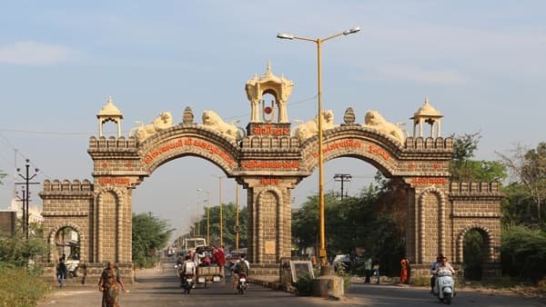
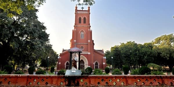
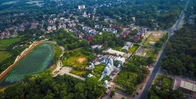
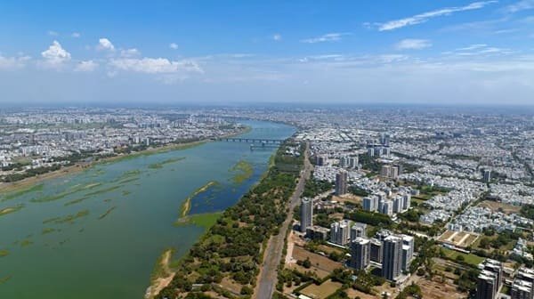
Surat is one of Gujarat’s largest and most economically important cities, located on the Tapi River in the state’s southern region. Its modern identity is closely linked with diamond cutting and polishing, textiles, synthetic-fabric manufacturing, trade, logistics and a large migrant workforce. Older commercial quarters around the historic city sit alongside rapidly developed residential and business districts such as Adajan, Pal, Vesu, Althan and Varachha, giving Surat a broad urban character rather than a single concentrated centre.
The city occupies a strategic position on the Mumbai-Ahmedabad corridor and has strong road, rail and air connectivity. Surat Railway Station is a major Western Railway hub, Surat International Airport serves the city from the Dumas Road side, and the municipal BRTS and city-bus network provides large-scale public transport within the urban area. Surat Metro Phase I is also under construction, with two planned corridors across the city, but it is not yet an operational transport option as of September 2026.
Quick About Surat City Gujarat
| Detail | Information |
| State | Gujarat |
| District | Surat |
| City administration | Surat Municipal Corporation |
| City character | Diamond, textile, trade and industrial hub |
| Municipal area | About 461.60 sq km |
| Main central PIN code | 395003 |
| Main railway station | Surat Railway Station |
| Airport | Surat International Airport |
| Operational mass transit | Surat BRTS and city buses |
| Metro status | Surat Metro Phase I under construction |
| Major road links | NH 48, NH 53, Ring Road and city arterial roads |
| Nearby/major areas | Adajan, Pal, Vesu, Varachha, Udhna, Hazira, Dumas |
Where is Surat City Located in Gujarat?
Surat is located in southern Gujarat on the banks of the Tapi River, around the middle of the Mumbai-Ahmedabad economic corridor. The Arabian Sea lies to the west, while industrial and port-related development extends toward Hazira on the coastal side.
The historic city developed around the old walled core and the Tapi riverfront, but modern Surat now spreads far beyond that area. Varachha and Katargam are major residential and commercial belts to the north and east, Adajan and Pal dominate much of the western side, while Vesu, Althan and Dumas Road represent newer southern and south-western growth corridors.
Surat Municipal Corporation’s current limits cover about 461.60 square kilometres. Because the city is large and densely developed, the exact zone or neighbourhood matters when estimating commute time, choosing a railway access point or deciding which road to use for the airport.
Surat City Zones and Main Urban Areas
- Old City and Ring Road: The traditional commercial core includes textile markets, heritage areas, railway-station-side business districts and dense retail streets.
- Varachha and Katargam: Large residential and diamond-industry-linked areas with strong local commerce and heavy daily commuter movement.
- Adajan and Pal: Major western Surat residential and commercial districts across the Tapi, linked with central Surat by several bridges.
- Vesu, Althan and City Light: Fast-developed southern and south-western neighbourhoods with apartments, offices, hospitals, schools and modern retail.
- Udhna, Pandesara and Sachin side: Important industrial and worker-residential areas connected with manufacturing, textiles, rail and highway movement.
- Hazira and Dumas corridor: The western-southwestern road belt connects the city with the airport, beach areas, major industries and Hazira port-side development.
Surat’s urban structure is highly decentralised. A person working in Hazira, Varachha or Udhna can have very different daily travel needs even though all three locations are within the wider Surat urban area.
Surat City PIN Code
Surat uses many PIN codes because of its large municipal area. A central code frequently associated with the railway-station and municipal-office side is 395003, but it should not be treated as the postal code for the whole city.
Major neighbourhoods use their own postal zones. Vesu, Adajan, Varachha, Udhna, Dumas Road, Katargam and other parts of Surat can carry different PIN codes depending on the exact post office and locality.
For bank KYC, GST registration, property documents, school forms or courier delivery, use the PIN printed on the exact building or official address rather than selecting a generic Surat code.
Road Connectivity
NH 48 / Mumbai-Ahmedabad Corridor
NH 48 is Surat’s principal intercity highway connection and links the region toward Bharuch, Vadodara and Ahmedabad to the north and Navsari, Valsad and Mumbai to the south.
NH 53 and Hazira Side
National-highway and industrial-road connections toward Hazira support port, manufacturing and freight movement and connect the western industrial belt with the wider road network.
Ring Road and City Arterials
Surat’s Ring Road, canal roads, bridges and major arterials distribute heavy internal traffic between textile markets, residential districts, industrial areas and the western bank of the Tapi.
| Road/Route | Useful For |
| NH 48 | Ahmedabad, Vadodara, Bharuch, Navsari and Mumbai corridor |
| NH 53 / Hazira links | Hazira industries, port-side traffic and regional freight |
| Ring Road | Textile markets and central commercial movement |
| Dumas Road | Airport, Vesu side and Dumas coastal corridor |
| Tapi bridges / western links | Adajan, Pal and western Surat connectivity |
BRTS, City Bus and Metro Connectivity
Surat already has a substantial road-based public-transport system. Surat BRTS and regular city buses operate across major corridors, and Surat Municipal Corporation reported 450 electric buses in operation under its BRTS system as of April 2026.
Surat Metro Phase I is under construction and is not yet operational as of September 2026. Gujarat Metro Rail Corporation lists a 40.35 km network with 38 stations across two corridors: Sarthana to Dream City and Bhesan to Saroli. The first corridor includes an underground section through central Surat, while the second is planned as an elevated route.
Until metro services begin, commuters should base current travel plans on BRTS, city buses, autos, cabs, two-wheelers and private vehicles. Properties should not be described as having present metro connectivity simply because a future station is planned nearby.
Bus, Rail and Airport Access
Surat Railway Station is the city’s principal rail hub on Western Railway’s busy north-south corridor between Mumbai and Gujarat. The city’s 2046 mobility plan identifies Surat station as the main railway node, with Udhna also serving as an important station for southern and industrial areas.
BRTS and city buses provide extensive urban coverage and connect residential areas with commercial, industrial and transport nodes. Intercity and regional buses also operate from major terminals for destinations across Gujarat and neighbouring states.
Surat International Airport is located on the Dumas Road side of the city. Airports Authority of India identifies it as an international airport, and its location makes it especially convenient for Vesu, Althan, Dumas Road and south-western Surat compared with the older eastern and northern parts of the city.
Nearby Areas Around Surat City
- Adajan: A major western Surat residential and commercial area across the Tapi, well connected with central Surat by bridges and BRTS routes.
- Vesu: A prominent modern residential and business neighbourhood near the Dumas Road and airport side of the city.
- Varachha: A densely developed eastern-northern area strongly associated with the diamond industry and large residential communities.
- Udhna: A major southern industrial, rail and residential zone with its own important railway station.
- Hazira: A major industrial and port-side area west of Surat, important for manufacturing, energy and logistics.
- Dumas: A coastal locality and leisure destination on the airport side, connected with central Surat through Dumas Road.
FAQs
Q. Is Surat Metro operational now?
No. As of September 2026, Gujarat Metro Rail Corporation still lists Surat Metro Phase I as under construction with no operational stations.
Q. Does all of Surat use PIN code 395003?
No. Surat has many postal codes. 395003 is a central code, but neighbourhoods such as Vesu, Adajan, Varachha and Udhna use other PINs.
Q. Which railway station is best for Surat?
Surat Railway Station is the main long-distance hub. Udhna can be more convenient for some trains and for residents in the southern industrial side of the city.
Q. Is Surat well connected by public buses?
Yes. The city has an extensive BRTS and city-bus system, including a large electric-bus fleet operated through Surat’s urban transport network.
Q. Which areas are convenient for Surat Airport?
Vesu, Althan, Dumas Road and other south-western neighbourhoods generally have more direct road access to Surat International Airport.
Q. Which road is most important for intercity travel from Surat?
NH 48 is the main Mumbai-Ahmedabad highway corridor and is the key road link for travel toward Bharuch, Vadodara, Ahmedabad, Navsari and Mumbai.